Port Bannatyne to the Crinan Canal

We left Bristol on Friday April 29th to travel north to Edinburgh to stay the night with Andrew, Rebecca and the grandchildren and pick up our sailing kit, left there the year before. We could not believe we were about to embark on a sailing odyssey – it was more like an arctic adventure as we passed through snow-laden hills and roads as we approached within 10 miles of Edinburgh.

Snow laden hills approaching EdinburghIMG_0697

But on the last day of April we left Edinburgh at lunchtime after Rosamund had indulged in a record provisioning shop. We could not believe we could get all those provisions on board particularly as we were planning to have Andrew, Hugh, Percy and Skye join us for the next two days.

Andrew had a crazy plan to leave his car at some junction on a bus route from Portavadie and catch the Colintraive Ferry across to Bute and have me (Ian) meet them all off the Ferry. In the end – the timing was such that it was quicker for me to cross the ferry myself and pick him up at the junction. The plan worked perfectly and by 8pm in the evening we were all enjoying a whole chicken roast cooked by Ros on the boat – the heat from the cooking being a welcome relief from the penetrating cold and a sea temperature of only 9C.

Catching the sunset on the FerryIMG_0699  We’d had a lot of work done on the boat when she was out of the water. The sail drive had to be rebuilt as seawater was in the oil, we had our wind vane renewed and linked to the Raymarine Chart. But there were a few teething problems which John Stirling, the local Marina manager, helped us sort out on Sunday morning before we left.

Rosamund and I were a bit reluctant to leave as wind conditions were Force 4 gusting 5, but Andrew persuaded us that we had protection from the Kyles and should be OK. This proved to be the case and we had a decent sail up the East Kyle but had to motor up most of the West Kyle as we were head into wind.

Keeping lookout up East KyleIMG_0702

We quickly passed by the Kames hotel where we’d moored last year and headed for Portavadie after we’d rounded the headland. It was getting choppier now with the wind freshening and  Portavadie was a welcome refuge.  It was a rough night with thunder and lightning and hail storms, but  by morning the sun was shining even though the wind was too strong to go sailing.

We breakfasted with the grandchildren while Andrew  travelled by bus to retrieve his car. He was back in no time and after a bacon buttie for a late breakfast we all headed to the Spa. It was fun to go outside on a freezing cold day and sink into a hot-tub with views across the white crested water of Loch Fyne – not a sail boat in sight.

The Portavadie SpaIMG_0717 IMG_0718

The next day we decided, despite the bad weather, to head across Loch Fyne to Tarbert.   After a short crossing we found the old harbour to be a refreshing change from the rather characterless buildings of Portavadie.

Tarbert HarbourIMG_0732

We walked into town later and had an excellent meal at Starfish with Ros being very extravagant and having their seafood special with lobster, crab, langoustines, mussels and loads of shellfish.

Ros’s Lobster extravaganzaIMG_0734

As the weather was bad for the next 2 days we decided not to explore further up Loch Fyne, but to sail to the Crinan Canal early the next morning. Leaving at 7:00am and with a high swell on the sea, we soon arrived at  Ardrishaig, the entrance port for the Crinan Canal.

We circled at least four or five time waiting for the sea lock to open – the wind was too strong to berth on the waiting pontoon.IMG_0740


The Kyles of Bute – 2015

We’d heard a lot about how beautiful the Kyles of Bute were, but four days weatherbound in Port Bannatyne was enough to dampen our enthusiasm. We did go out on one of the grey wet days to venture up Loch Striven by sail and back against the wind by motor – but the beauty of the Loch escaped us behind the mist, the driving rain and the clouds.

What a contrast the next day – to sail in sunshine goose-winged with a following wind up the East Kyle. What is a Kyle anyway? After much research it turned out to be the Scottish word for a Strait – like the Straits of Gibraltar. A narrow passage of sea between two land masses. The Isle of Bute fits to the mainland like one of those tessellating shape games (Tetris) where the diamond shape has not yet been fitted into place. The Kyles of Bute comprise two narrow Straits or Kyles – one running NW to SE (the East Kyle) and the other running NE to SW for most of the time. Sailing through the Kyles of Bute is a challenge for any sailor as the wind tends to funnel along the Kyles or suddenly changes as the topology of the surrounding hills changes. Even the locals warned us that the winds were unpredictable. They also warned us to steer clear of the Waverley as the captain had a reputation for ignoring sailing vessels and steaming straight on at 14 knots regardless.

Sailing through Caladh HarbourIMG_7922

Our sail to the meeting of the two Kyles was uneventful and luckily for us, we did not meet the Waverley as we navigated our way through the narrows of the Burnt Islands to the lovely anchorage of Caladh harbour and round the island of Eilean Dubh past Caladh Quay where it looked like a youth club were preparing their boats for a sailing race. Leaving Caladh we started tacking our way into the head wind making very slow progress as the winds were light. But now we were not in a hurry to get anywhere – we had all the time in the world and the scenery was beautiful with numerous yachts on the move – some sailing, but the majority motoring. We passed Tighnabruaich looking for potential mooring places, but Rosamund had read about the Kames Hotel that had its own mooring buoys for yachts. And they were very welcoming and served excellent food. We had a very peaceful night on their swing mooring. The sunset was exquisite and the views from the boat in the morning so peaceful and smooth – such a contrast to the four grey rainy days earlier.

Sunset in KamesIMG_7948


A trip to Post Office in Kames the next day led to the discovery of many effigies in the village. Was it an early Guy Fawkes day? No, there was a scarecrow competition in Argyll and Kames and their residents had made a number of innovative contributions.

Kames Scarecrows

IMG_7972IMG_7968IMG_7970

We tried tacking south against the Southerly wind the next day. We even “raced” against another Hunter Legend 306 – but a lull in the wind persuaded us to motor to the headland where we could get a better course for sailing with the wind on our port beam all the way to Portavadie. We called it Portaverdie as it sounded slightly Italian. It was a new Marina with 250 berths and masterchef restaurant and a massage/beauty/therapy centre with an infinity pool about to open at the end of the year.

Our first course in the Portavadie Marina RestaurantIMG_7987

Berthed next to us was a huge motor cruiser Reala II – the owner said he hoped I would not mind, but he’d taken a picture of our boat to send to his daughter in Australia as her new partner was called Milo!! What surprised me when discussing his boat was that it could go 20 mph but used 225 litres of fuel per hour. Admittedly Milo could only manage 5 knots or 5.5 mph, but it only used 1.4 litres of fuel an hour – quite a contrast.!!

Our last day returning to Port Bannatyne was a 21nm sail and this time we did sail all the way. The winds were stronger so we were able to make 4-6 knots most of the time. The West Kyle was a breeze and the Southerly wind channeled behind us to push us quickly up the West Kyle to the Burnt Isles. We had to tack through the narrows between Bute and the Burnt Isles and then came across both the Colintraive Ferry and the Waverley while beating into a strong wind with little leeway. We managed to tack across the ferry on the starboard tack but had to go about just before the Waverley passed – so at one point it looked as if we were on a collision course, but she was travelling very fast so passed across our bow with about a hundred metres to spare.


The Waverley crossing our bow very close and at speed

IMG_8001

Then we tacked up the whole East Kyle and, as time progressed and we were half way between low and high tides, we must have been tacking against a strong tide as I noticed our track was getting more and more concertinaed.


Milo Picture from Reala II

OLYMPUS DIGITAL CAMERA


We were thankful to arrive back in Port Bannatyne and berth at our familiar berth and assumed it was coincidence that the rain was starting yet again.

The next day Ian took the ferry to the mainland and then the bus to collect the car from Ardrossan, returning to Port Bannatyne Marina to load up for our return journey to Edinburgh for the Festival.

Milo was lifted out the following week and while on the crane had some mast-top repairs done to restore the missing wind vane and fit a wind vane.

Milo in winter storage until April 29th, 2016.

IMG_8077


It’s an ill wind ……

They say “It’s an ill wind that blows nobody any good” – sailors of course love the wind. It gives them their free ride. They pitch their skill against it, play with it to go as fast as they can in the direction they want to go, but they do respect it, as they know it can become wild.

Nowadays we are fortunate to have so many predictive aids to anticipate those ill winds – and today there were 3 days worth of gales predicted so we sought a safe haven and are delighted to have found Port Bannatyne on the Island of Bute as we’ve been looking for somewhere to leave Milo over winter.

Port Bannatyne Marina owes its existence to the energy of just one man – Martin Stirling. He started building a jetty in 2005 by quarrying the stone locally from the island, bringing it down by the lorry load as and when he could adding more and more to the growing jetty. Although there was some local resistance, by 2009 he had opened the Marina with its 105 berths. He was managing director for its first three years before, by chance, he became the owner of a run down mussel farm which he took over in 2012 and he has now turned this into a potentially thriving business with a turnover of 500 tonnes of mussels a year. His son John now runs the Marina business and Adam, John’s son, is learning the trade. It is certainly a friendly organisation and everyone we have talked to has had nothing but praise for its founders and the management.

IMG_7851       IMG_7859

In port we met a sailor who had the most elegant Drascombe Coaster, rescued from 4 years of neglect after the passing of its previous owner – lovingly restored and about to be sailed, despite the impending storms, across to Largs to pick up his daughter. Later that evening he was back, delighted that his Coaster had topped 7.5 knots on its return. The next day despite the impending gales, he set off with his daughter for Lamlash on Arran. He was planning to settle there with a friend on a farm and give up his job in Oxfordshire. This seeded further thoughts about getting a Drascombe Lugger for Branscombe. Also he had sailed in many risky situations, including on the yacht, Cheeki Rafiki that later lost its keel crossing the Altantic with the loss of all aboard.

On the first evening Ros, the food scout, booked us into the Russian Tavern at the Port Royal Hotel. The restaurant had some good reviews on TripAdvisor and we were intrigued by the idea of Russian food on the Isle of Bute. The meal was a very strange experience with the owner rather too persistently attempting to make conversation with us, the only customers of the evening – even Ian, who is normally pathologically friendly, ended up saying “do you mind if I talk to my wife – we have a lot to discuss!”. The Borscht soup was rather tasteless and the scallop dish underwhelming. The Geogian wine was excellent and we finally ended with vodka that finally gave an authentic touch to the evening.

The next evening we planned to walk to Rothesay, but were picked up by John Stirling in his black van on his way back home. Dropped at the centre of Rothesay, we now had the benefit of John’s recommendations and, finding a number of seafront restaurants closed, we ended up at the Victoria Hotel on the first floor with a magnificent view across the bay and the food there was better than we expected.

IMG_7873

The rain was relentless the next day, but after we’d done more “catching up” with our work we decided to walk across the island to Ettrick Bay, passing along the way St Colmac’s Stone Circle surrounding the tree below, one of two known stone circles on the island, consisting of 8/9 stones set on a rough circle of 15m in diameter thought to be 4000 years old. The view across to Arran was stunning.

IMG_7885

Return to Lamlash

Returning to Lamlash on Arran on the 1st August was like a timewarp – it was as if we had never left. Yet in the month away so much had happened: Pete & Chris’s barn dance in Tunbridge Wells, our wedding anniversary, Ian’s trip to China, Cath & Rick’s 100th party in Shepherd’s Bush, Vyv & Skye’s trip to Legoland and, of course, the usual family gathering at Eastcotte in Branscombe.

IMG_7834

And yet, returning to Lamlash, there was Jim, still as we’d left him sitting in his chair in the Holy Island Ferry portacabin office, saying “she’s weathered a few good storms since you’ve been away” – knowing that Milo had been well looked after and cared for on her mooring.

IMG_7838

Once again Jim kindly arranged for us to be taken by boat to Milo. The sunset that night was as if Arran was on fire – glorious and so peaceful – the real calm before the storm, but we were determined to leave despite the inclement conditions setting sail for Port Bannatyne on the island of Bute early the next day – we’d heard it was a peaceful place and sheltered for weathering the impending storms – but more on that later.

Milo had not been too lonely while we had been away. Andrew, Rebecca , Hugh, Percy and Syke had all stayed on her for the weekend of July 10-12th. Unfortunately for them there were high winds so they could not sail, but instead they motored to Holy Island, anchored and climbed to the summit. The views from Holy Island were spectacular.

IMG_0374

IMG_0338

IMG_0448

I asked Hugh and Percy if they’d like to make a contribution to the blog and these are their contributions. Hugh wrote, “At first, when we got to Arran I was exited. I thought we were going to see Granny & Granpa”. Percy was more forthcoming: “We started the journey with the drive to Ardrossan to get the ferry. Once we got we got on the ferry Andrew and Percy had a look around top deck to watch the hull closing whilst the others made paper aeroplanes. After the quick look around they all had a snack (whilst making paper aeroplanes). When the ferry journey was finished they took the bus to Lamlash. When there they went to a nice little place called the Drift Inn. We figured that the only way to get to the boat was fore (sic) Andrew to swim in his wetsuit. They even asked someone who said no! Whilst Andrew was swimming Becky, Skye, Percy and Hugh had tea.”

IMG_0387

Lamlash

We would be leaving Milo in Scotland for a month and wanted to leave her in a  beautiful place. As we sailed between Holy Island and Arran and entered Lamlash bay we knew we had arrived at Milo’s temporary resting place – there was no discussion, both Rosamund and I were adamant that this was where we would like to leave Milo – in a beautiful place sheltered from the prevailing winds. But when we landed and spoke to Jim of the Holy Island Ferry Company, we learned that the Brodick-Ardrossan ferry was on strike the next day and there was no way that our son Andrew would be able to meet us with his car.

IMG_7243 (1)

Andrew does not do “not possible” – even though he only got back from Rotterdam late on the Friday night, he left with the kids (Hugh, Percy and Skye) early on the Saturday morning to catch the 11:10 ferry from Ardrossan to Brodick as foot passengers. We decided to sail to meet them at Brodick and this was a different sort of sailing with no urgency. We were able to sail all the way even when the wind dropped, we just waited for it to rise again – unlike the earlier passages when we had to get to a particular port by a particular time to catch the tide. This was another taste of things to come – a new more relaxed sailing schedule.

IMG_7269

It was lovely meeting the Ardrossan ferry towering over us like an ocean liner. There they were on the galley way below the bridge – Andrew distinctive with his huge rucksack and Hugh, Percy and Skye recognisable by their energetic waving.

IMG_7285

We’d moored Milo in the middle of Brodick harbour and we were soon all on the boat. First a briefing to the new crew on the rules: no toilet paper down the heads, life jackets to be worn at all times when on deck, harnesses to be clipped on when going out of the cockpit and on the front deck, and only then with permission of the skipper, and no hanging about in the companion way. We explained that the wind was fresh and could get fresher when we rounded the headland, so no-one was allowed forward of the cockpit.

We were not disappointed – we had to tack back to Lamlash with a force 4 wind, occasionally gusting 5. Hugh wanted to have a go at the helm and although Milo was difficult to hold when tight hauled and slightly over-sailed, Andrew explained to him how to hold the course by looking at a recognisable point in the distance and then cross-checking with the compass. After a while Hugh said, “I’m getting the hang of this, Las Vegas here we come”. Where that came from we weren’t sure but we all laughed and did not like to say that Las Vegas was landlocked – maybe he was thinking of Los Angeles!

IMG_0073

We tacked to get into Lamlash harbour past the port marker buoy for coming out. Our plan was to anchor off Holy Island and then climb to the summit, but it was far too exposed and choppy so we decided to moor in the relative calm of Lamlash which was sheltered by the Kingscross Point headland. Andrew was set on barbecuing, but plans for a beach barbecue had to be abandoned due to the worsening weather and it was starting to rain. Andrew persuaded us that his barbecue had a cold bottom so could stand on the port transom seat. We were able to put the canopy up leaving the aft port flap folded back to expose the barbecue to the elements. Later as I was relaxing on the starboard transom seat having a well-earned gin and tonic, I noticed a tender being rowed past with two people aboard – half joking I said, “fancy a gin and tonic?” – “are you serious?” replied the oarsman, “I’d love one.” We welcomed them aboard – a father (Tom) and his son from Hamburg.  Their outboard was not working and Tom had had to row about a mile through strong winds and choppy water to get back to his boat Baxkiste, which was moored downwind next to ours – no wonder he was willing to stop for a rest and a gin and tonic. He’d been trying to get the outboard motor fixed as their whole family had planned a meal out at the Drift Inn that evening. Always wanting to problem solve, I suggested they could borrow our outboard as we were not using it that evening – an offer they took up later that evening. These chance meetings at sea are always fun as we learned from them some places to explore further north and we were able to recount some of our experiences on what would be their route south.

IMG_7294

It was a fine meal with steaks, hamburgers, sausages and salad followed by a selection of cheeses – then getting the kids ready for bed after their early start that morning. The first chapter of Arthur Ransome’s Peter Duck was the incentive to get them to bed early. Snug in the front cabin – the skipper (Ian) between the three writhing youths slowly gained their attention with the story which involved the Swallows and Amazon’s going to sea in a ketch with Captain Flint – appropriate, as we’d just completed our first group voyage aboard Milo.

That night turned out to be the worst night of our whole trip – gale force winds, noise from the rigging, crashing beer bottles across deck in the middle of the night, non-stop pitching and rolling, but by 8am the winds began to moderate and after a full English breakfast

IMG_7300

we were swimming off the back of Milo and Skye and Percy were bailing the water out of the tender. The water was very very cold (11.6degC) but was refreshing – not water to linger in. All the kids dipped in but came straight out again with a yelp.

IMG_0023 IMG_0013

Time to get shipshape and leave. I always feel anxious when leaving Milo on a mooring, but Jim had given me confidence by riding by to inspect our mooring warfs before we disembarked. He also promised to keep an eye on her and kindly came out to pick us up with all our luggage and deposit us on the quay – that way we could leave the tender on Milo lashed to the foredeck without worrying about her – “how much do we owe you, Jim, for the taxi service”. “oh nothing he said, you’re a customer of mine now.”

IMG_7322

We all took the bus to the Ardrossan Ferry and Hugh, imitating his father, insisted that he carry the rucksack – much to the amusement of the passengers on the bus who applauded and cheered him when he did eventually manage to turn round in the gangway on an overcrowded bus without disabling too many passengers.

IMG_0041

At Ardrossan, we squeezed into Andrew’s car and returned to Edinburgh and a lovely welcome home meal prepared by Rebecca after her heavy on-call day at work.  It was strange for Rosamund and I to return to civilisation, but it had been a gradual and relaxed 2 day process before we eventually returned to Bristol and home again.

A taste of the wild

From Stranraer we decided to head straight for the isle of Arran as the weather was worsening, hoping to meet Andrew and kids there two days later at the weekend. We were not disappointed as the route to Arran took us past a small island called Ailsa Craig. On the chart it looked tiny but even 5nm out in the mist it looked like a huge volcano rising out of the sea.

IMG_7156

As we approached there were increasing numbers of northern gannets and guillemots flying near the boat. The gannets are huge – distinguishable by their black wingtips and their peach coloured necks. They flew high and kamikaze dive-bombed into the sea, making a huge splash.

This photo montage illustrates how a Northern Gannet (Morus bassanus) dives for fish in the Atlantic Ocean.

This photo montage illustrates how a Northern Gannet (Morus bassanus) dives for fish off Aisla Craig in the Firth of Clyde, Scotland (adapted from swanson-media.com).  

As we passed close to the lighthouse on Ailsa Craig we could see a ruined church tower or castle on the hill and a few ruined houses near the remains of a landing strip. We could well have headed straight onto Arran as there was little sign of wild life on this side of the island, but as we were progressing well with the tides we decided to circumnavigate the island. Along the north side were the remains of an old mining railway line, bridges and what looked like a kiln. We read in the pilot book that the island was indeed volcanic and was made of granite – a very fine granite that was used for making curling stones.

IMG_7162

As we rounded to the north face of the island we began to see the first of many gannet breeding colonies – then on the west side seals on nearly every rocky outpost. Sometimes they slid into the water as we passed, at other times they did not, preferring to brazenly stare at us.

IMG_7174

The north and west sides of the island were vertical sheer cliffs with numerous ledges formed from crystallised granite ideal for breeding birds. There were so many gannets that the cliffs looked snow coloured, the noise was deafening and the smell of iguano strong. For the first time we felt that we were approaching wild places — a taste of things to come next year when we would explore the western islands.

IMG_7188

We set sail for our final destination – Arran feeling elated by the Ailsa Craig experience. As we approached Arran the winds moderated and we saw Holy Island emerge from the sea in its full glory shrouded in mist and mystery.

IMG_7218

Crossing to Scotland

It was just over year ago when holidaying with the grandchildren in a croft cottage in Badrallach a little north of Gairloch that we had the idea of sailing to Scotland. Seduced by the thought of voyaging by boat between the Western Isles we wondered if we could sail along the coasts of England, Wales and Ireland to reach Scotland.

Arriving now in PortPatrick in Dumfries and Galloway we now realise that this is just the beginning of a new adventure. Will we sail to St Kildas in the Outer Hebrides? Will we sail to Eday in the Shetland isles? Will we sail around the Northern tip of Scotland to Betty Hill where the Mackay side of our family gathered after the Sutherland clearances. Would we sail into Poulteney Town (now Wick) where my great-great-great-grandfather, Robert Sutherland, was a fisherman and mysteriously disappeared at the age of 40 in the 1840s? Will we travel through the Caledonian Canal? Will we circumnavigate the United Kingdom and travel down the East Coast, visiting places where Ros’s mother grew up in Norfolk? Imagining new voyages and ventures for next year, the first year of my 70s, is both delightful and daunting.

IMG_7104

Crossing the North Sea from Ardglass in Northern Ireland to Portpatrick in Scotland was beautiful – one of those blue sky almost cloudless days that you’d love to have on the beach as there was no wind – but not sailing. Initially the winds were light and from the South and coming from behind us. It was a good opportunity to try the shute for the first time.

IMG_7090

Seeing the north sea like a mill pond reminded us how capricious the British weather can be. One day calm and the next day stormy. Sea ports all have tales of those lost at sea and this has taught us to respect the sea and plan carefully – if in doubt do not set out.

Portpatrick-BlackGuillimots

In fair weather we have started to observe the bird and wild life around the boat – particularly guillemots and gannets. In Portpatrick we were berthed against the harbor wall from which we were treated to a lovely display from a group of black guillimots on how to dive and “fly” underwater.

Black Guillimot-Noss-D141Black Guillemot – its red feet clearly distinguish it from the common Guillemot 


To Northern Ireland

The significance of this trip was that we were again crossing borders – this time from Eire and the Euro to Northern Ireland and the pound sterling. We left Carlingford Lough on the flood tide – what a contrast to two days before – we were out on the high seas in just over half an hour with the treadmill, but it had taken nearly 2 hours against. Carlingford flew a beautiful rainbow flag as we left – how they did it, we do not know, as we could see no rain.

IMG_3573

While the passage to Ardglass was uneventful, it was special to us as it was the first passage that we could sail most of the way. The winds were fresh force 3-5 and we were on a broad reach and making good progress.  Also we had a clear view of the Isle of Man with its distinctive mountainous profile.

IMG_7050

On arrival in Ardglass we found Doyles a welcoming cafe for lunch and enjoyed some of the most delicious fish we have ever eaten. In the evening  Ros created an amazing omelette using up all of our on-board ingredients.

IMG_3577


The Oysters of Carlingford Lough

I’m dedicating this post to Rachel Roddy for three reasons. Firstly it was her blog that inspired this one, secondly she writes about food and thirdly the Roddy family on the male side hail from Carlingford Lough  and Greenore.

What I love about Rachel’s blog is that it interweaves the food preparation with the local culture in both the UK and Italy so that the food you prepare from one of Rachel’s recipes gives you more than just the taste, there is the story behind it, the history, the source and the seasoning.

Eating on the boat while you are sailing is not easy – particularly when you are beating against the wind and the boat is angled at 45 degrees. Frequently you hear the sound of plates and mugs crashing across the galley onto the floor. The best we have done for lunch are Rick Stein’s biscuits and a lump of Lancashire  cheese. On a calmer day we have even managed something heated up from a tin – beans on toast.

IMG_3551 (1)

But arrival in port is a different scenario. During the voyage Ros will have researched the best restaurant in town and in Carlingford our choice was The Oystercatcher Bistro run by Harry and Marian Jordan.

We both chose oysters for our first course – how could you not when on the menu it said, “coming to Carlingford and not having its oysters is like going to Paris and not visiting the Eiffel Tower or New York without visiting the Statue of Liberty”. Put that way we had no choice.

IMG_7022

They arrived in their shells on a bed of olive green seaweed. They were delicious. The locals say that the unique sweet taste and high meat content of the Carlingford Oyster is one of nature’s real treasures and it is rumoured that the Romans brought the cultivation of oysters to Carlingford.

Later the chef, Harry Jordan, came to talk to us. He was passionate about the Carlingford Oyster and how it should be eaten. He thought additives like lemon and Tabasco (although provided) spoilt the real taste of the oyster. He explained that oysters take about 3 years to grow and can filter over 55 litres of water a day. It is the nature of the local water that determines the flavour in each oyster. Carlingford Lough is unique in that there is a huge exchange of water with each tide which provides the nutrients on which the oysters feed. In addition, freshwater flowing in from the mountain sides north and south of the Lough give Carlingford Oysters a very rich and distinctive flavour – a sweet slightly nutty one followed by a slight tannic and lingering after taste.

Harry’s passion for his oysters has now extended to an oystercatcher van. He now dispenses oysters to passers by in order to give as many people as possible the opportunity to experience their unique taste. He added that talking to us, with us sitting at our table and him standing over us, was as if he was telling us what to do and how to eat the oysters – he could not really do that. But in the street he was on a one-to-one with the passers by and could look them in the eye – they had no chance of getting past Harry without tasting at least one of his oysters.

So Rachel, my challenge to you is to compare how oysters are prepared and taste in Carlingford, the land of your forefathers, to those in Sicily where I know you have gained great insight from Vincenzo’s grandmother’s recipes and if, along the way, you can come up with some simple tasteful recipes for sailors to prepare on the high seas – that would be great as there is a huge market out their looking for inspiration.


Entering the treadmill at Carlingford Lough

Howth to Carlingford Lough

On reflection we should have left Howth at 8:30 to enter Carlingford Lough at high water at about 3pm. In practice we left at 11:30 after taking advantage of our first marina internet access at Howth Yacht Club. I think we were lulled into a false sense of security by the fact that all the tide charts have slack water in the Irish Sea off Dundulk Bay and Carlingford Lough, so if we left with northerly tide flows it would not really matter when we left. The winds were predicted westerly 3-4 rising to 4-5 about 6pm, but we found virtually no wind at the beginning of our voyage and so had to motor sail. We even shook out a reef in the main we’d had the day before in order to gain some advantage from the very light winds – which we came to regret later.

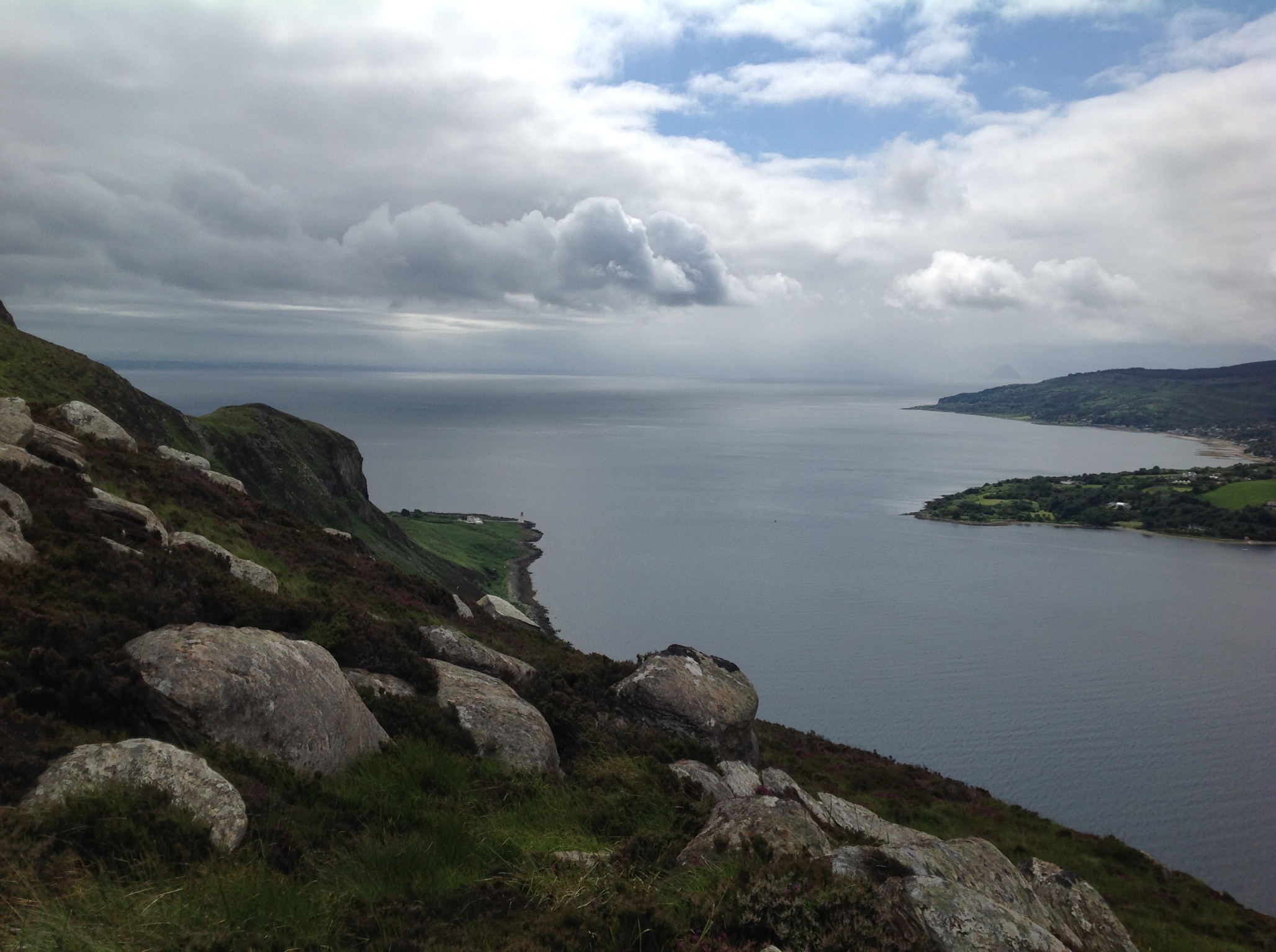
The sail past Ireland’s eye off Howth, then Lambay Island and on past Rockabill Lighthouse was lovely. The weather looked set fine, at least where we were, but there were rain clouds north, south and east of us.

IMG_6932 Ireland Eye off Howth with its white guano covered rock on the right

IMG_6936 Passing Lambay Island with the Ireland Eye in the distance emitting smoke – we were not sure if this was a controlled stubble fire or an out of control bush fire as it had been going on for several days

IMG_6943Passing Rockabill lighthouse in the middle of the bay – much like the Eddystone lighthouse off Plymouth Sound except this one has a large house on it. 

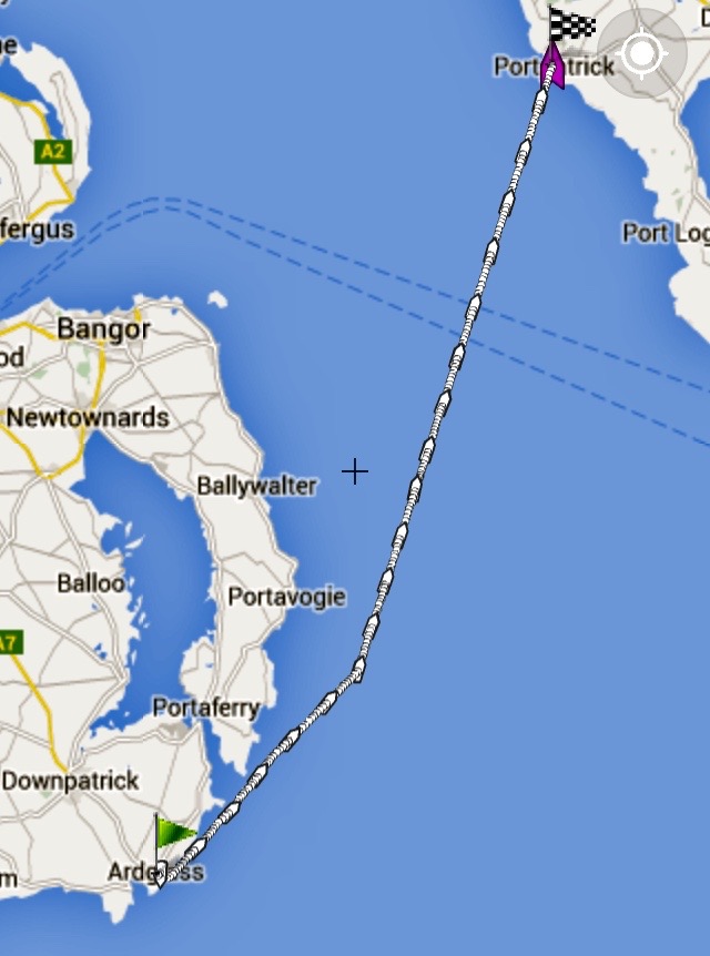
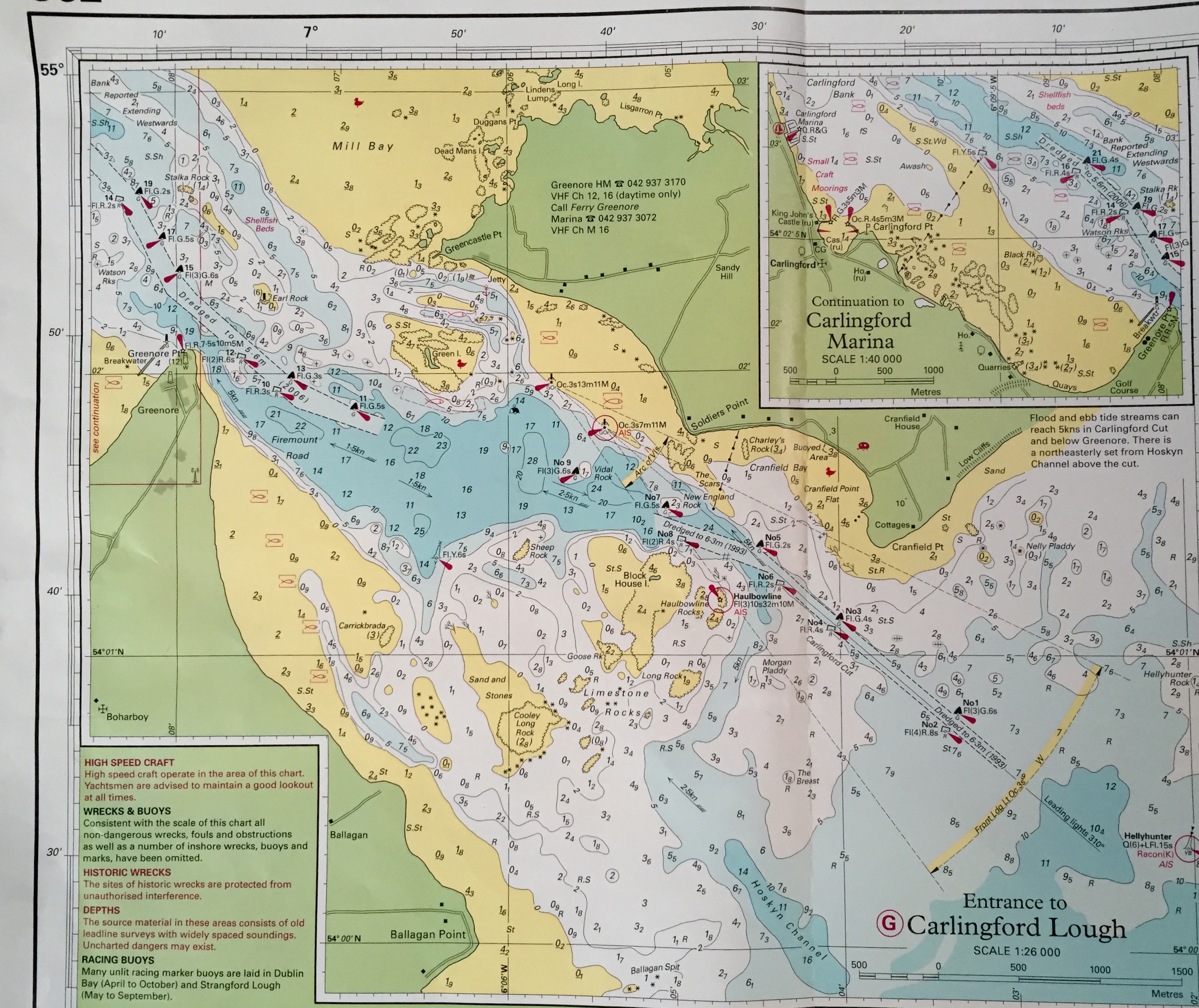
We then read about Carlingford Lough – “Tides run fast in the entrance of Carlingford Lough” said the pilot guide with a picture of the current round one of the buoys. Ros called Carlingford Marina and they could give us a berth – “ pick up any one you fancy” was the response. I then spoke to them about the tidal streams coming in and out of the Lough – “4-5 knots”, “Oh” I said, “My engine only does 5 knots!” – “Let us know if you get into any trouble” was his reply. We then looked at the chart. It did look complicated. There was a “dog-legged” channel dredged in 1993 for the first 2500m (1.5nm), marked by pairs of green and red bouys – first 1-2, then 3-4, then 5-6, then 7-8. The odd buoys being green and the even buoys being red – seemed simple, but by 7-8 they were starting to stagger. Then there was a lone starboard buoy (No 9) as you entered a wider channel and then a further lone starboard buoy (No 11) as you entered a second multiple dog-legged channel 3600m (2nm) which was dredged in 2006. From then on there were a further 8 buoys all higgledy piggledy, 13, 15, 17, 19 and 21 starboard buoys and 10, 12, 14, 16 port buoys ending in the pairing 16-21 as you entered the main Lough and deep water. In between the two channels there was a short respite of about 2000m (1.1nm) of slightly deeper water, which we were thankful for later when an unexpected event happened.

IMG_6970 (1) IMG_6987 Overview of passage plus detail of buoyage into Carlington Lough

When motor sailing we’d worked out we’d arrive at Carlingford Lough at 6pm when the exiting tide would be in full flood (ie 5knots) so we decided to take our time and sail there slowly entering the Lough about 8pm when the tide had eased – which was great. It was lovely to have the motor off and relax in a gentle breeze – most of our other trips had been more pressured to get to a port by a specific time, but now we were not in a hurry – well we weren’t, but the wind had other ideas. It slowly increased from force 3 to force 4 gusting 5 and we were sailing faster and faster. We eventually arrived at the Carlingford Lough entrance buoys 1 and 2 at 6:30pm only half an hour after maximum flood tide. I do not know why I made this decision, but we were going so well under sail that I decided to sail in through this narrow channel. We were making 6 to 6.5 knots through the water, but when we entered the channel we had to change course and we were very close hauled and healing over at quite a steep angle as we were now rather oversailed for the wind. It led to an exciting sail, but with very slow progress creeping in at about 2-2.5 knots.

IMG_6954 
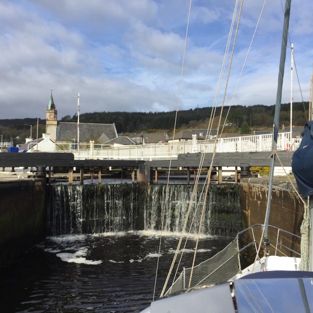
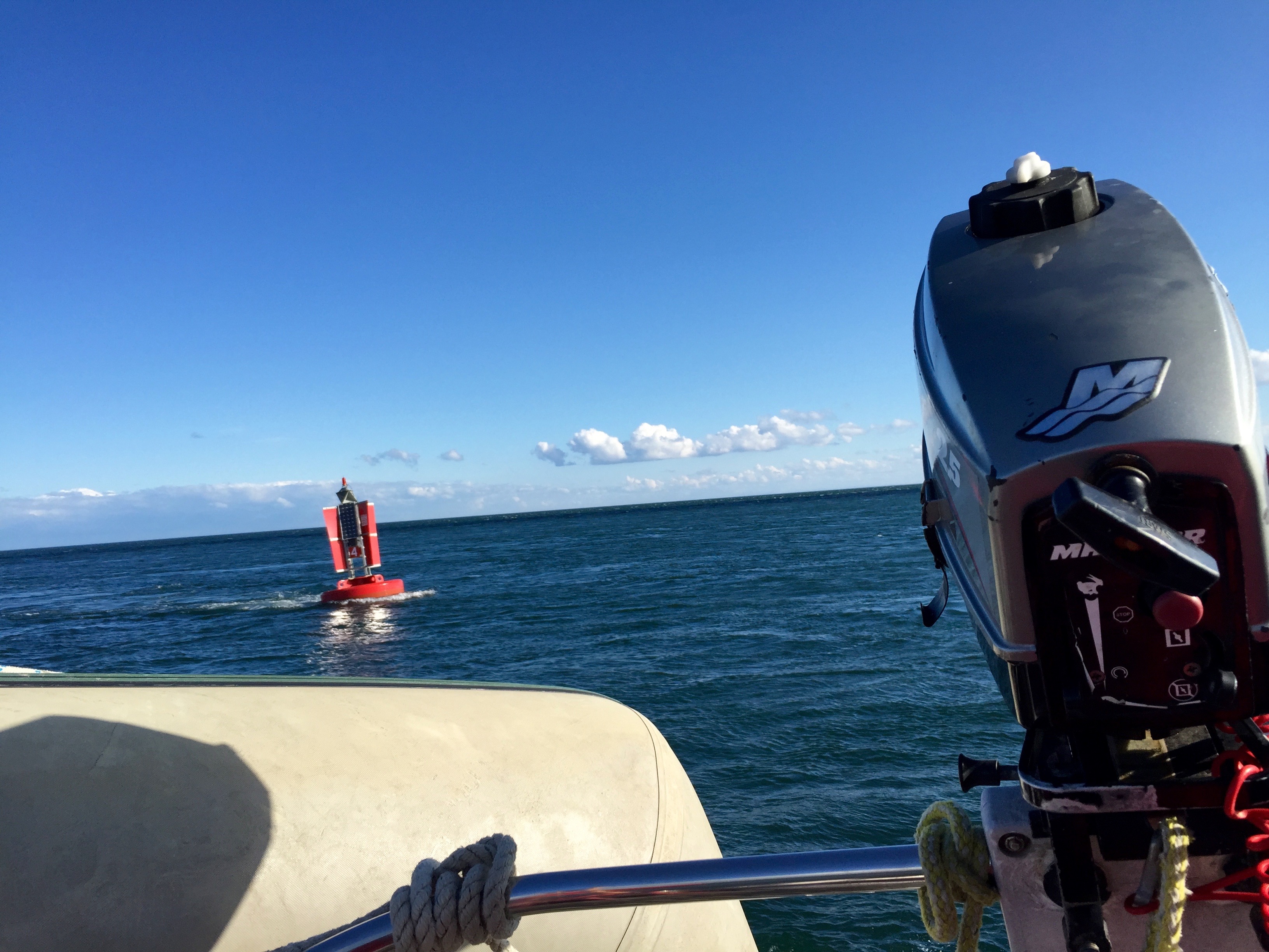
Port Buoy No 4 at the entrance to Carlingford Lough showing the force of the outward flowing tide of 4-5 knots.

It was like being on a treadmill and running as fast as you can but hardly getting anywhere. Can you remember as a kid trying to run up the down escaltor and seeing if you can get to the top – stop for a second as you run out of breath and you go backwards. Well this was a bit like that but we were on a water treadmill sailing like the clappers but getting nowhere. My worry was that the wind would suddenly drop and I’d go backwards – I had the engine in reserve of course but this would only give us an extra 2 knots at the most. It took half an hour for us to creep through the first channel and then we had a short respite as the treadmill slowed a bit in the deeper water and we started to make 3 knots. Suddenly from nowhere there was this loud foghorn sound and there in front of us it looked as if a section of the side of the mountain was moving toward us – it was the 14,759 ton Seatruck – Clipper Pennant as we saw later as it passed. It came out of the sun and was backlit so we had not seen it, but it was huge and bearing down on us at great speed as it had the 4 knot tide with it. The horn meant that it had no manoeuverability, so even though I was under sail, I had to give way. Unfortunately, I was loughing up to lose wind in the gusts and this took me right into its path so I was forced to bear away to starboard causing us to heel wildly until Rosamund could loose both main and jib to spill wind and take us to the extreme edge of the channel. As it passed close to port and leeward of us, we lost all wind and were probably heading backwards for a while on the treadmill until what appeared to be ages later when it had passed and we picked up the wind once more and headed for the second channel. It took us almost two hours to do the 4.6 nautical miles through the entrance to Carlingford Lough but on the treadmill we’d done 9.1 nautical miles as I later learned from my log and trip meter.

IMG_3558The Clipper Pennant – a RoRo Transport Ferry passing close on our port beam doing 12 knots heading for Heysham, England.

Carlingford Marina was certainly a haven for us from the high winds that were now developing from the west. In the lee of Carlingford Mountain it gave great shelter. Being in a fiord the harbour did not need the protection of a conventional sturdy harbour wall. Carlingford was, like the buoys, another higgledy-piggledy arrangement. I remember as a kid how I used to love building things with packs of cards – starting with two to make a triangle, then another two and then place one on top to stabilize it – repeat this a number of times and you get a structure on which you can build more structures and so on. Take one link out and it often collapses. Well Carlingford harbour seemed to be constructed rather like that and in their case there were some links missing. There was also a huge concrete ship in the middle of the harbour – that acted like a landing stage. You had to cross this ship to get off the marina up metal stairs that were fixed relative to the pontoon, which meant that the concrete ship was actually floating and anchored.

IMG_7013 
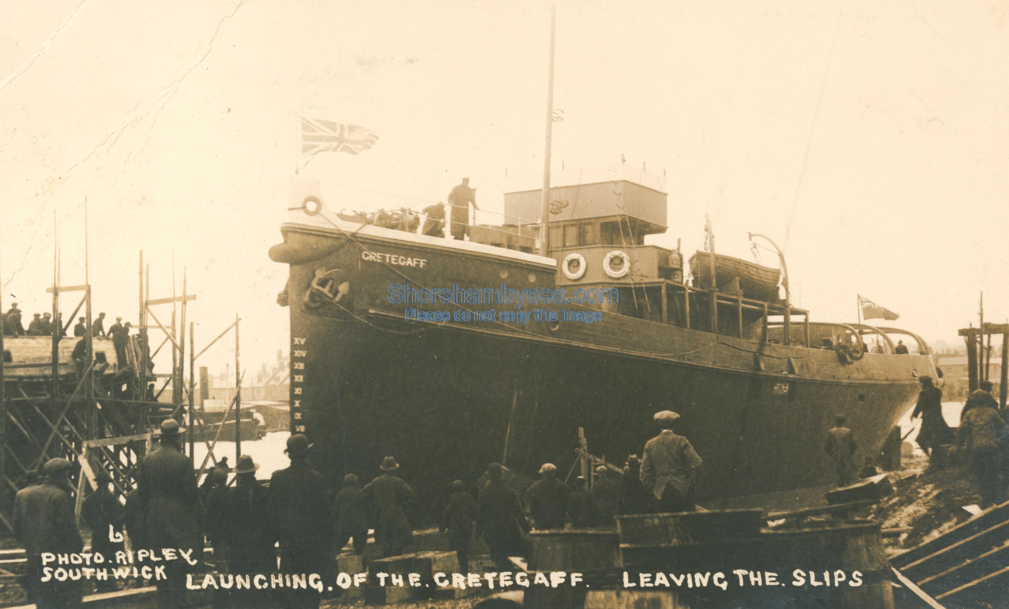
The Cretegaff in Carlingford Marina today.  Had been the clubhouse before the new one in the background was built and is now the fuel barge and deck to reach the pontoons.

An except from Isle Of Man Today gives some of the history of this vessel – ‘During the First World War, when steel was in short supply, the British Government commissioned a series of sea-going barges designed to carry 1000 tons of coal. A number were built of reinforced concrete at various locations around the country. To pull these barges a small fleet of concrete ocean-going tugs was also built.

‘Both the tugs and the barges had names which began with the word Crete and the idea was to use them to transport coal to Europe and Russia.

‘During the Second World War a further series of concrete barges was constructed. The durability of the material is borne out by the fact that there are still a number of such vessels in existence today, although no longer in commercial use.

‘In the 1930s one of the large ocean-going tugs, the Cretegaff, was purchased by a Captain Stephen Portus, who was a pilot and tug owner in the port of Garston on the River Mersey. For a short time he undercut the Isle of Man Steam Packet Company for the job of bringing in to the Island the English daily newspapers.

pp_shorm_89969_20120305_1599678102Launch of the Cretegaff in 1917 in Southwark 

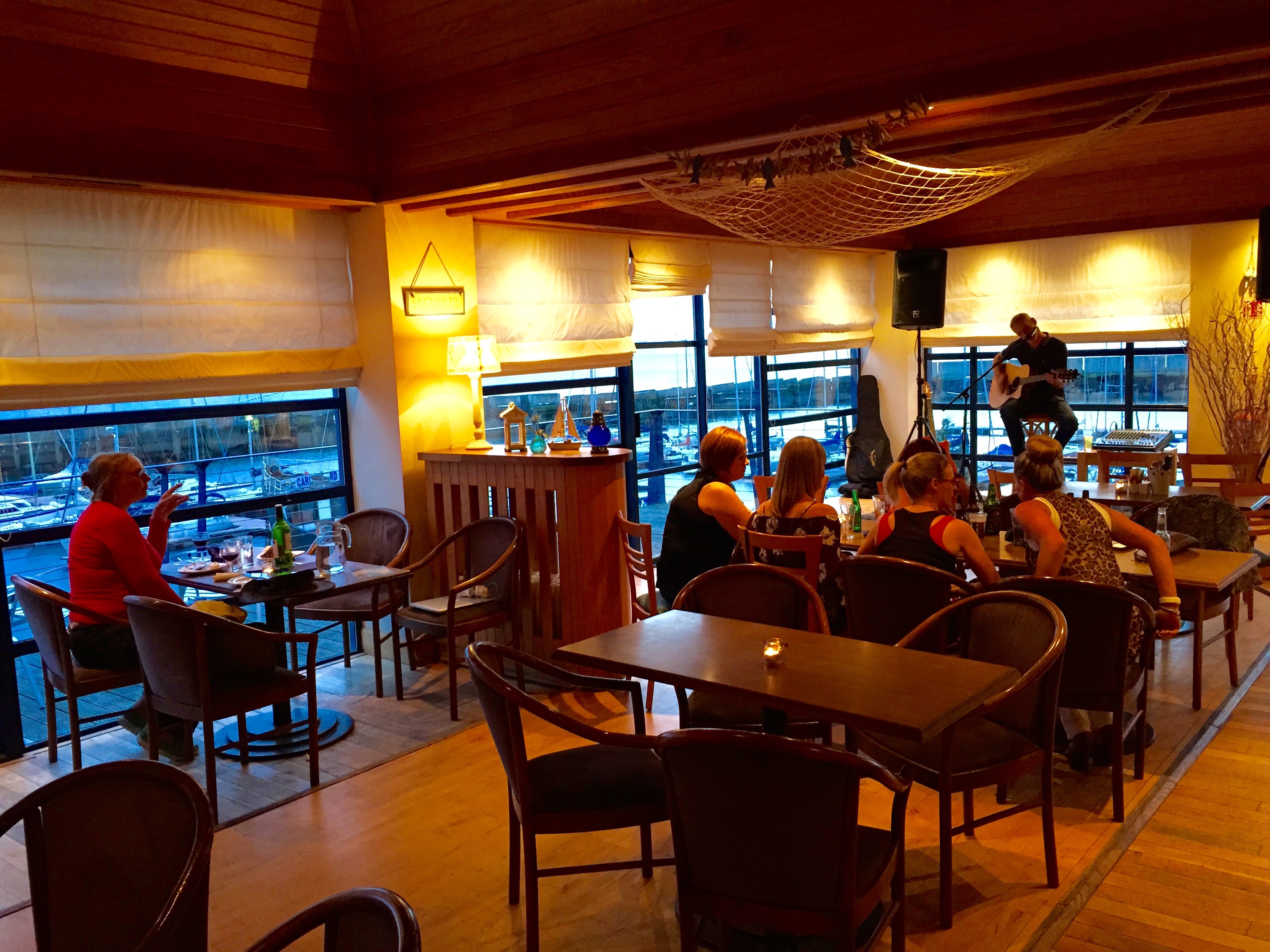
When we went into the clubhouse to see if we could get some food we discovered that Saturday night was “music night”. A party of women had just arrived for a birthday celebration and there was a live music show just being set up. We were greatly entertained while we ate our meal, by the live music and the craic.

IMG_6969

IMG_6967Live music at the Carlingford Yacht Club.

Leaving relatively early compared to the Irish, I said to the waitress when paying the bill how much I’d enjoyed the music. ” Oh, that’s just as well” she said, “he’s my husband!”