Monthly Archives: May 2016

Return from the Hebrides

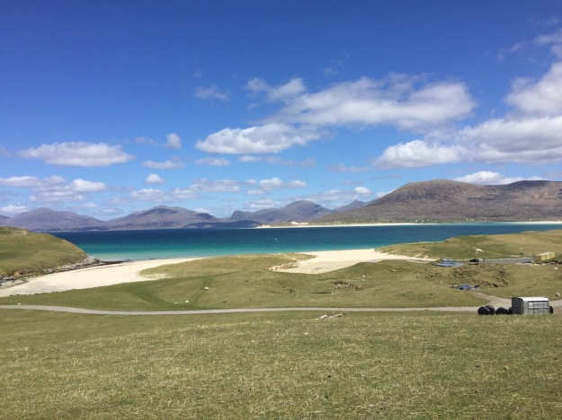
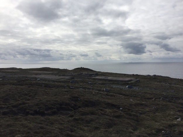
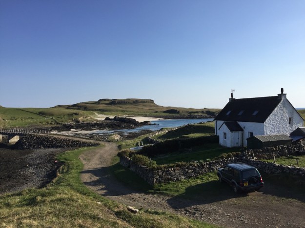
Our return to the boat from the Isle of Harris in the Hebrides was constrained by the need to get back to the boat to meet Steve Tanner, a Raymarine Specialist who would get our AIS (Automated Identification System) working. We arrived later than planned – about 5:30pm in the evening – we had found a Co-op open on a Sunday on our route back so we took the opportunity to re-provision. Steve was still at the marina. He was installing a new VHF high aerial for the harbourmaster. The harbourmaster’s assistant Coll, same as the island, was helping him. “I’ll be another hour” he said “and then I’ll come and sort out your AIS”. Coll said he was working late at the marina as a big boat was about to come in. It was the Harvest Caroline II, a fish food distribution ship. He told me that near the marina was a large warehouse which was the distribution centre for fish food – this was loaded onto the ship – which is why the ship had such a large crane on board and the ship filled hoppers on the fish farms that now had automated feeding systems. An auger (much like an Archimedean lead screw) took food pellets from the hopper to feed the fish – he explained that there was a video camera about 5m deep and if it detected pellets falling that far – they knew the fish had had enough to eat as normally they feed near the surface and there was a frenzy of activity at food time. In earlier times the feeding would have been done by hand, but there was great risk in strong winds – so now the fish can be fed under any weather conditions quite safely. Ros has added the comment that the idea of farming fish fills her with horror and she will check more carefully that she is not eating farmed fish when dining out in restaurants in the Western Isles. Interestingly what was a fascinating engineering problem for Ian has become an environmental one for Ros.

Harvest Caroline II returning to Loch Boisdale Marina and turning on a sixpenceIMG_1209 (1)

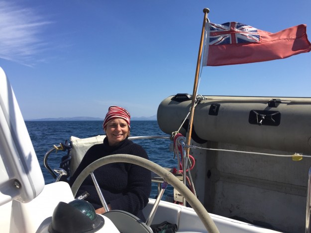
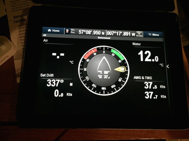
By 6:30pm Steve joined us on the boat to check out the AIS – he explained that the reason the AIS (Automatic Identification System) was not working was the Baud rate was wrong – he had set the right value required for the AIS and this was now working – in fact an alarm went off in the harbour as there were two other boats with AIS within 0.5nm, our alarm limit, so we knew it was working. When we checked the wind anemometer it was working also, so Steve was not needed after all, but while he was there I asked him to train me in the use of the Raymarine chart recorder and help me set it up as I needed it. This he did brilliantly and I ended up with readouts of both depth and true wind speed and direction on the chart – with relative windspeed and direction on the instrument panel. Furthermore – he explained how I could interrogate the AIS and set up targets to display potential collision information continuously. Chatting to him later, it turned out he was looking after Raymarine navigation systems and other electronics for the whole of the Hebrides. He worked amazingly long days but enjoyed his work so much that it was not a problem for him even though some jobs did not finish until midnight

Later that evening I spent a long time searching for our flag pole and red ensign along the harbour shoreline, lost during the gales, but did not find them. I took the hire car back first thing in the morning and then prepared for the sail back to Tobermory via Canna. We had decided to return on Monday regardless of whether the engine had been fixed or not as the weather was going to worsen by Thursday 19th May. I looked at alternative routes but the winds dictated the way to go. Both Rosamund and I were delighted at the prospect of returning to Canna as we wanted to do some walks on the island, visit the gardens at Canna house and return to the marvelous food at Café Canna.

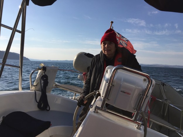
We had the wind on our port beam (just) on the way back – enough to try out the shute for the first time. It took me a long time to work out (again) how to use it. But here’s a picture just to give you a bit of colour.

Top – Sailing with the Shute on Milo and bottom – a tanker passing across our bowIMG_1217   IMG_1215

In the end the wind dropped and we had to take the shute down and motor sail. As we had not repaired the leak we developed a strategy of motoring for an hour – turning off the motor and sailing (whatever the wind conditions) and bailing out. We were shipping about a bucket and a half of water an hour, which was contained in the well below the engine. Previously, when we had not understood the problem, we would have motored for four hours then got some heavy winds and sailed – this tipped all the water which was retained under the engine into the bilges and with the boat heeling quite severely the water then found its way everywhere – including our food locker under the port bench seat in the cabin. Our new strategy worked perfectly and we did not even get any water into the bilges. Moral – know the cause of the problem and you can probably find a way around it.

We had a lovely part sail, part motor to Canna. The wildlife was vast and varied. We saw a Dolphin (just one) and puffins as well as gannets and guillemots but sadly no eagles despite sailing past the tall cliff where they were nesting.

We moored in the harbour at Canna and I went ashore to the Café Canna to catch up on email and the blog, to find that lobster was on the menu the next night. The photo below shows Anna holding the two lobsters she’d just brought from the harbour by bicycle for clients that evening – they were alive and active which is why Anna is looking rather apprehensive – she was keen to get them to Chris in the kitchen.

Picture of Anna with the lobsters

IMG_1233

So after a meal on the boat and a restful night, in the morning we found the rain forecasted for the next evening arrived at least 6 hours early and we weathered out the storm on the boat by having a lovely cooked breakfast followed by reading and then a little work. By 4pm the rain had eased and we went ashore and had some tea and cake at Café Canna – we met a sailor from the “Wylde Swan” a Dutch herring carrier, a tall ship that was anchored just outside the harbour entrance but in the lee of Sanday. We learned that they’re also come from the Hebrides and had visited St Kilda, but the day they came back was quite rough and she’d rolled a lot.

Wylde Swan at anchor in the outer harbour at CannaIMG_1246

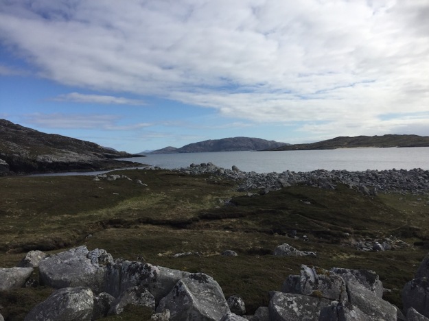
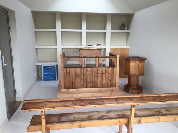
Rosamund and I went on a walk to the castle, which used to be a prison where we could see the Wylde Swan anchored in the bay. Later we visited a small church on the north side of the harbour and then walked onto the ferry terminal where we met crew and passengers from the Wylde Swan. The next day they were heading for Tobermory – “Ah so are we “ said I “what time are you leaving?” – they said about 10am. We left at 7am and expected them to overtake us at some point but we never saw them – it turned out that they had gone via the Islands of Rhum and Eigg and called off at every one. In the end they arrived at Tobermory one hour after we did, but it was still lovely to have a tall ship moored in the harbour.

Top: passing the Wylde Swan when leaving Canna; 2nd from top: cruise ship National Geographical Explorer in Tobermory harbour; 3rd from top left Navy Cadet training ship T.S. John Sherwood and bottom: The Ocean Youth Trust Scotland yacht Alba Explorer 

IMG_1258IMG_1271

IMG_1273IMG_1275

Tobermory harbour the night we arrived was chaotic. Firstly a cruise liner arrived and anchored in the bay – rib after rib arrived with life-jacketed passengers sitting on the side – “Welcome to Tobermory, you have an hour and a half to explore – may I suggest you visit the pub called ‘the mishnish’ on the other side of the harbour and walk up to the higher part of the town where there are magnificent views of the bay” – later I talked to one of the crew, who turned out to be one of the Naturalists aboard –the liner was the “National Geographical Explorer” and, they had started in London and were now heading back to Lewis before crossing via the Orkneys to Denmark where their cruise ended. There was also a Royal Navy cadet training boat, the T.S. John Jerwood and a huge yacht owned by the Ocean Youth Trust Scotland offering sail training for young people – the port was heaving.

The next morning the cadets had obviously been told to walk to the headland and back – returning to the boat at 8pm and within 2 minutes of their return, the Jerwood had left!

Thursday 19th May was a bad weather day with lots of rain and high winds – it was an opportunity for us to get repairs done on the boat. The harbourmaster, Paul Traynor, had put us in contact with Philippe, who was an amazing character. He was French from Chamonix on the border of Italy and France, he’d been in Tobermory for 20 years and seemed to know everyone. I was interested to learn about repairs to sea-water pumps as one day I may have to do this myself. I shadowed Philippe the whole time – including time spent in his delightful workshop in the upper reaches of Tobermory. It was a complicated job involving precision engineering and many of special tools. I decided it would be better to carry a spare sea-water pump, even if this were an expensive option.

View across the harbour and the Sound of Mull from Philippe’s workshop in upper Tobermory

IMG_1282

With the weather changeable and the auto-helm being mended we decided to start heading home on Sunday, earlier than we had planned. Picking up the car on the Isle of Bute would be an adventure in itself, an almost 9 hour journey by bus, two ferry crossings and train journeys. We were now in a very slow-journey mode of being and so the long journey would be a pleasure. And as Ros said it is remarkable that you can leave the car on one island, sail for three weeks, moor on another island and then find public transport to take you back to your car again.

We will travel via Edinburgh to watch Hugh and Percy sing in a choir in a folk concert called Songs of Separation,  performing in the Queen’s Hall on Monday May 22nd. Then back to Bristol for a few weeks before returning to the Western Isles in the middle of June.


The Isles of Harris and Uist

Although the winds had eased slightly by the morning it was a no-brainer to hire a car and explore by land. The winds were from the NW, which would have made it very difficult for us to sail to Harris as planned. One of our aims was to find out where Rosamund’s father, Percy Hatfield, was stationed in the war. It was very top secret at the time and even Ros’s mum did not know where he was. Here’s an excerpt from the eulogy that was read out at Percy’s funeral:

“After he finished his RAF training he was asked where he’d like to be stationed. He said, “Yorkshire” so he could be near where Joan was teaching. But he was sent to the Island of Harris in the Outer Hebrides, to a village called Islivig and put in charge of a radar station.

 They planned their marriage for April 1942. Percy’s wedding bans were called in a little church in Islivig. But instead of calling them on three consecutive Sundays, they called them 3 times on one Sunday. Joan’s bans were called in Yorkshire.”

So we had a village name, Islivig, and had to be on the look out for a little church. But where exactly was the radar station – a search of secret Scottish radar installations found two in the area – and one was called Islivig radar station and there was a pointer on a map which enabled me to fix it exactly by the topology.

Information from http://www.secretscotland.org.ukIMG_1137IMG_1132

Our main problem to get there was a logistical one. Initially not knowing how far it would be, Ros had booked the first night in Port Maddy (one of the ports we might have berthed in if we had managed to venture north) in North Uist but still well short of our destination. We stayed at Hamersay House (01876 500 700) and checked in early to drop off our gear and then took a walk around the village. There was a village store, an information centre, a museum and a small marina. At the information centre we made enquiries about Islivig and found that that it was quite remote – although only 25 miles as the crow flies from the ferry terminal, Leverburgh on South Harris, it was 80 miles by road. We decided to take an early ferry on Saturday May 14th from North Uist to Harris arriving in Leverburgh at about 11am, and booked a B& B in South Harris (Found with the Sawday book given to Ros by her sister Julia). Whereas the hotel in Port Maddy was adequate the B&B in Borve, Isle of Harris was amazing, and provided Ros with the peace she needed to get over the very rough crossing from Canna to South Uist. It was run by Lena and Richard MacLennan and was called Pairc an t-Srath (01859 550386). Everything about it was wonderful, the friendliness of the owners, the magnificent sea view, the breakfast kipper and coffee, the bath and the Harris tweed upholstery of the furniture.

View from near our B&B in BorveIMG_1144

After checking in – we left at about lunchtime to make the now 70 mile journey to Islivig (the map we obtained from the information centre, however, used the Gaelic name, Islibhig). We stopped in Tarbert to visit the Harris Tweed shop and Ros bought some beautiful red and black tweed, possibly to upholster our old dining room chairs. But before any more “making” projects Ros has to finish Skye’s Fair Isle jumper that she has been knitting since last summer. Somehow she had lost one of the knitting needles and luckily was able to find what she needed at a charity shop in Tarbert.

Progress on Skye’s Fair Isle jumperIMG_1238

When we left Tarbert to travel North it was around lunchtime and we were now both getting rather peckish but there was nowhere to eat. On and on we drove past the most amazing scenery on single track roads with parking places which became smaller and smaller. In the middle of the afternoon, we did at last, find a café. We stopped to enquire if we could eat there later on our return, but it was fully booked and could only offer tea and cake that we readily accepted as by then we were very hungry. We enquired whether there was anywhere else – “the Auberge” said the lady, offering her phone to call them, but there was no reply. Oh well we thought, we’ll see if we can find it.

We continued on our way to Islivig, but the location of the radar station was meant to be at least two or three miles before this tiny village and sure enough we could see remnants of the buildings on the left hand side of the road as we were travelling south along the coast road towards Islivig. We parked and walked up the hill and were delighted to find the foundations of an enormous WW2 radar establishment. We photographed as much as we could so that we could draw a plan and then perhaps match this up with WW2 photographs of radar establishments when they are eventually released. We even found a bunker, which was fully operational with air vents, but it was totally flooded so we could not go in. There were so many concrete foundations that we estimated that there must have been at least 50-100 men stationed there. Earlier when I reminded Ros that her dad had been in charge of the radar station – she’d said “Oh yeah – probably a man and his dog” but this was clearly not the case.

Remnants of the Islivig radar station – the view to the hill behind, numerous foundations and Ros standing by the bunker.  We even found the toilet block.IMG_1150IMG_1152

IMG_1156

Driving into Islivig later we could not find a church and we ended up at the end of the road where there was meant to be the ruins of a Nunnery, but we could not find these either. Interestingly we could now see across to where we had started our journey two hours previously, but there was no road link across the water.

The end of the road and the view south across to ScarpaIMG_1166

Returning, Ros thought she saw a church down a road to our left – we followed it – but it wasn’t – it was a private house, but our passing must have been the excitement of the day for two dogs that chased down the road after us. After we turned round we came across the owner of the dogs and chatting to her, she told us that there used to be a little church about a mile or so south of Islivig in Breanais the next village.

Small church just south of Islivig built on the site of the old church where Percy’s bans were read.IMG_1175

The Church of Scotland had recently put up the land for sale and it was sold under the condition that a meetinghouse of a similar size was built on the site of the original church. This we found, only a mile or so south of Islivig. We learned from the dog lady that there used to be a thriving community in Islivig during the war – a note on an historical tourist sign included the following paragraph:

“The most recent ruins seen here are the remnants of the military operations that took place from 1941 to 1946. Two or three hundred men were stationed at Mealastadh and Breanais to operate wireless and radar installations. There was a cinema, a bar and regular dances, but when the war was over they all left.”

The scenery was majestic. The mountain behind the radar station had a shape similar to the sugar loaf near Abergaveny and we wondered whether this early mountainous territory with panoramic sea views influenced Percy’s later choices of where to live – South Wales and Branscombe.

We could see across to the island of St Kilda, which we had hoped to sail to, but decided that this was a step too far for the ventures and voyages of the Sutherlands. Ros enjoyed imagining her father in 1942 looking out to this island, several years before she was born.

View across to St Kilda from the Islivig radar station siteIMG_1157

On our way back we found the Auberge Carnish – “Come in, we’re open” said a sign in the door. It was 6:30pm in the evening. The place seemed deserted, but eventually we heard activity in the kitchen and tapped on the door. A slightly disheveled and flustered French masterchef appeared – apparently he had a full restaurant that evening at 7:30. Yes he could squeeze us in at this tiny table for two, but we had to go away and return at 7pm. This we did and were not disappointed – the food was delicious, small delicate dishes full of taste and beautifully arranged. We could not believe that this restaurant existed in such an isolated location.

The view from the Auberge restaurant

IMG_1180

Later on the road to Stornaway, we visited the Calanais standing stones which rounded off an extraordinary day.

Standing stones in CalanaisIMG_1192

Isle of Canna to the Outer Hebrides

I write this now we’re safely berthed in Loch Boisdale’s new marina, we’ve been trying to reconstruct the amazing change scenario that happened during the day we sailed from Canna to South Uist. We set off in a relaxed fashion at about 10:30am – we knew that if we motor sailed we could get to Loch Boisdale within 5 hours as the total trip was only 28.3 nautical miles. But when we ventured out we found the winds were light and behind us, blowing us along at a gentle 3-4 knots and it was sunny and intoxicating, so why not take our time and sail the whole way across.

Ros enjoying the the first part of the trip leaving CannaIMG_1088

The Island of Canna retreating in the distanceIMG_1086

The downside of not motor sailing in light winds is that you do not make much progress. By 3pm (when we could have arrived) we were still 12 nautical miles out, but we’d had a lovely relaxed lunch at sea, had been having fun bird watching, reading and planning what

The approaching Hebrides with groups of three mountains – large on the right (North Uist), medium in the middle (South Uist) and small on the left (Barra) – our approach was to the left of the three medium peaks.IMG_1091

to do on Uist and Harris when suddenly everything changed – the wind freshened and veered to the north so that we were more closed hauled and the sea state became considerably worse. Earlier we had called the Stornaway coastguard and learned that the winds were cyclonic and freshening to 4(5) later but our computer wind predictions put this at about 10pm in the evening, not 3pm in the afternoon.

We put the motor on and in no time were breezing along motor sailing between 6.5 and 7.5 knots. We’d be safely in port within two hours we thought, but as we got nearer and were hoping to get some relief from the lee of the land – we found it getting rougher and rougher with wave heights reaching 2m. Later we were told that NE winds in the Minch are the worse case scenario as they have the whole length of the North and South Minch to build up. Another reason it was difficult for us, was that we had decided when the winds were light to shake out the reef in the main that we had started with, so we came in with near gale force winds under full sail. While Loch Boisdale harbour sheltered us somewhat from the waves – the wind was persistent – it took quite an effort to get the sails down. When we came into the tiny new harbour of Loch Boisdale the wind was blowing so hard it was difficult to manoeuvre. Luckily the harbourmaster helped us with our lines and another boat owner pitched in, but it took all their strength to bring us in – at one time we were blown broadside between two pontoons.

Wind conditions on arrival in our berth showing gale force 8IMG_1114

Despite the howling winds, the noise and pitching about even when berthed, Ros managed to cook a delicious meal, with venison steaks that we had bought in Tobermory.

Ros preparing mealIMG_1097

The evening was one of contrasts – despite gale force winds – the sunset was glorious. A routine engine check led to the discovery that the water pump was leaking and we decided to hire a car the next day to travel north while the problem was being fixed. Ros did not take too much persuading to find a comfortable hotel on our route north. She later admitted that she’d been rather frightened at the end of that last hairy leg of sailing to the Outer Hebrides.

A lovely sunset despite the gale force windsIMG_1099

Tobermory to the Isle of Canna

As the winds were freshening during the day and the tides were in the right direction early in the morning to get us round the Cape of Ardnamurchan, we left with the sunrise and were soon sailing north with easterly winds.

Sunrise at TobermoryIMG_1052

We had a flexible plan which, depending on wind strength and direction could see us ending up on Eigg, Rhum or Canna. In the end the winds favoured Canna and after an energetic 3 hours on a quite rough broad reach we were approaching the Sound of Canna and rounding the NW corner of Rhum.

Ros looking worried on a broad reach on the western side of Rhum where the high mountains made the easterly wind direction a bit unpredictable!IMG_1058

As we started the motor about 5nm out to head through the straights against the wind we suddenly lost all power and all our navigation aids. By this time the winds were so fresh that we had to focus on sailing – so we came into Canna Harbour the old fashioned way using charts and landmarks. Fortunately the visibility was clear, as when approaching the harbour we noticed we were heading for some semi-submerged rocks marked by a red buoy on their right. We changed course to round the buoy on the correct side and enter the safe anchorage of Canna Harbour. There are now 10 mooring buoys in Canna Harbour and we chose the most northerly one to give us protection from the rising northeasterly winds.

Milo on the most northerly Canna mooringIMG_1068

Posting Becky’s birthday card proved difficult. There was no post box evident so I tried to hand it to one of the deckhands on the departing ferry to be told “leave it in the cab, I’ll deal with it when I get back”. Behind me there was a big van being unloaded into a warehouse and a man there confirmed I could leave it on the front seat on top of two mailbags intended to go to the mainland with the van on the ferry later. I enquired about paying my landing fee and was told I had to go to the community shop across the bay where there was an honesty box to put it in. Apparently the whole island is now owned by the National Trust. There are only 19 inhabitants and in addition a few archeological volunteers who were spending a week on the island helping to explore the 1200 ancient Celtic sites. Also, next to the Community Store, which incidentally was unmanned – you helped yourselves to stuff and pop the money into another honesty box, I discovered Canna Café, with WiFi, that provided a menu for the evening.

Cafe Canna in the distance with the Community Shop on its rightIMG_1070

Rosamund had been planning to cook that night. “I have no communication on the boat – our phones don’t work” said I. “Don’t worry” said, Anna call us on the radio – Channel 8”. Later I learned we were the first radio booking they’d had this year. Eating there later we had excellent advice from a local fisherman on where to sail over the next few day and, perhaps more importantly, where not to sail, which included advice on where to leave our boat after this stint of sailing.

Promise of a fantastic beach in the distance – to visit another timeIMG_1079

Rosamund and I had a lovely walk around the harbour part of the island – while I went to discover a nearby sandy beach Ros spoke to some of the locals – two of the archeologists and a woman who lived on the island with her husband and four children. Two of her children went to the school on the island and her older son was a weekly boarder at a secondary school in Mallaig. Ros learned that there are only three children at the local school, and thought that this would be a wonderful place for children to grow up. We will definitely return to stay in the hotel on the island and to eat again at the café where Ros ate the best fish so far on this voyage.

Tobermory, Mull and Iona

We fell in love with Tobermory and decided, just like that, to stay three nights. Use the first day to sort ourselves out – do the washing, buy a new toaster from the hardware shop (fantastic store selling everything – went in to buy one thing and came out with four) – chandlery next door to buy the Outer Hebrides Pilot Guide and a great book shop just nearby. I then spent some of the day fitting a new inverter so that we could charge up our computers when we were in remote places and then went on a tour of the local whiskey distillery.

Tour of Tobermory distillery – Tobermory and Ledaig Malts – the latter more smoked and peatie IMG_0961

Fixed up a car hire from the local garage that also ran the fuel pontoon – so we filled up the boat too.

The drive to the Iona ferry at Fionnphort was memorable for us because we were retracing the route we had sailed but were seeing it from a different perspective and from a higher altitude – we even passed by Loch Spelve where we’d moored earlier.

Once we arrived on Iona we found a local crafts shop that also prepared a fantastic coffee – retail and coffee therapy combined could not be resisted by Rosamund and half an hour later she was the proud owner of an Orkland hand knitted jersey which looks wonderful on her. An incentive to sail as far as the Orkneys.

We then headed for the beach at the north end of Iona passing the Cathedral and a distinctive Celtic cross – on closer inspection it was dedicated to Elizabeth Sutherland by her husband the 8th Duke of Argyll in 1879. I wondered whether this could possibly be a grandmother or great-grandmother of the Elizabeth, the 24th Countess of Sutherland (currently 95) who generously sponsored Andrew for £100 when he went to Svalbard at the age of 18.

 Cross dedicated to Elizabeth Sutherland married to the 8th Duke of ArgyllIMG_0986

Both Ros and I took a dip in the sea and inspired another man to go in in his underpants. It was near freezing (not quite – 10.7C) and you realised you could not survive for long in that water temperature – after this  Rosamund and I were much more careful to wear life jackets and clip-in whenever doing anything at all risky.

Coming out after a cold dipIMG_0996

On the way back we visited the Abbey (Cathedral) – this was closing a circle for Rosamund and I as we had seen the book of Kells in Dublin the year before on our trip to Scotland and now we were seeing where it had been written. It was peaceful and spiritual and I loved seeing the pictures of monks rowing to the mainland

The cloisters at the AbbeyIMG_1013

Copy of the book of KellsIMG_1022

 The principles of Columba, who settled on Iona in the 9th century, and the boats used at the timeIMG_1021

After a tea and cake at the Argyll Hotel while waiting for the ferry, we drove back to Tobermory via the west coast of Mull – the scenic route. While the roads were very rough (described as “weak” on signs) we had fun spotting and avoiding pot holes. We passed the island of Ulva and could see this would be a good place to visit in the future.

We arrived  back to Tobermory just in time to get fish and chips from the chippie on the harbour front

Tobermory via Ardfern and Loch Spelve

Crinan in the early morning was spectacular in the sunshine, with perfect reflections as the sea lock gates opened. But the sacrifice for this perfection was no wind and motoring to Ardfern – the sails were not even raised.

Perfect reflections looking toward the sea lock from Crinan Basin IMG_0883

Leaving the sea lock at Crinan with Jenny above operating the lock remotelyIMG_0895

Jenny, who operated the lock gates, waved us off and we were in Ardfern within two hours and helped into our berth by a friendly harbourmaster. Arfern is a very large marina run by the Ardfern Yacht Club and boasts one of the best chandlers in Scotland.

 Map of walk from Ardfern across the peninsula of Kintyre toward Craqbh HavenIMG_0913 (1)

Arriving early we decided to walk across the peninsular. It was a beautiful and peaceful walk with lovely view across the outer islands from the top of the hill.

Looking south down Loch Craignish that we’d sailed up earlierIMG_0903

Looking southwest toward the islands of Scarab, Jura and IslayIMG_0908But we did not walk all the way to Craqbh as we’d booked dinner at The Galley Lorne in Ardfern, a restaurant with a beautiful view down Loch Craignish. We both ordered battered fish and chips and when the owner asked Ros how the meal was – she chickened out from saying “terrible” – both the fish and chips were undercooked and soggy – a disappointment. I went to the local shop early the next morning to buy some venison sausages for the next night’s meal in Loch Spelve.

Our route through the Straits of Luing trying to avoid being pulled into the Corryreckon between Jura and Scarba and then meeting serious overfalls off CullipoolIMG_0923 (1)

Although we started our Voyage to Loch Spelve at the right time to round Dorus Moor at slack water, the weather worsened during the day and by the time we’d negotiated whirlpools, and vicious overfalls just after passing through the sound of Luing and had anchored in Loch Spelve we were exhausted. As we anchored we could see other sailors braving the winds, rain and choppy seas to go ashore for free wine and mussels (courtesy of the local mussel farm). But we were cold so put the heating on and settled for venison sausages on the boat.

Venison sausages and lentils

 IMG_0930

The weather situation at 9pm anchored in Loch Spelve with high winds and rain causing our anchor to drag and the necessity to employ a kedge anchor as a backupIMG_0928 (1)

The storm had passed by dawn, the skies had cleared and by the time we raised anchor there was no wind and Loch Spelve was a peaceful anchorage.

The few remaining yachts in the Loch Spelve anchorage by the time we left for TobermoryIMG_0940

We sailed up the Sound of Mull, passed Duart Castle that Ros had visited with Joanna, Dan and Vyvyan in 2013, and on with the tide behind us to Tobermory. – a welcome arrival and the beginning for us of a few days off to catch up on washing, do jobs on the boat, explore the town, visit the distillery and hire a car to visit Iona.

Entrance to the harbour at TobermoryIMG_0949

The Crinan Canal

There is something remarkable about the Crinan Canal. It was built between 1793-1801 with further improvements made in 1816 and a new larger sea lock installed between 1930-1932. Its route across the neck of the Kintyre Penisular saves a distance of 80 miles and avoids the treacherous seas off the Mull of Kintyre.

Crinan Canal MapIMG_0815

200 years ago the canal was a thriving industrial transport route for puffers – steam cargo boats that moved coal, furniture and farm produce up and down the canal.


Puffers at Crinan in the mid 20th centuryIMG_0889

The picture above shows two puffers. Vic 32 is still operating today – preserved as a tourist attraction and Auld Reekie which is being restored in the boatyard. I came across her the evening we arrived in Crinan and tied up against the harbour wall in the Crinan Basin. After eating at the Crinan Hotel’s Fish Bar there promised to be a wonderful sunset. Walking round the headland after our meal I came across the boatyard and, as I passed through the yard, met another photographer keen to catch the sunset. He was English and had lived in Scotland and worked in the Crinan Boatyard since 1960. He’d been working on refurbishing Auld Reekie – a welder by trade and in the picture below you can see evidence of new boilerplate welded skillfully to replace a rusted bulkhead on her starboard side.

The Auld Reekie being refurbished in the Crinan boatyard IMG_0866

Sunset from the boatyard at CrinanIMG_0872
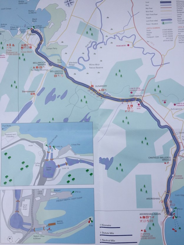
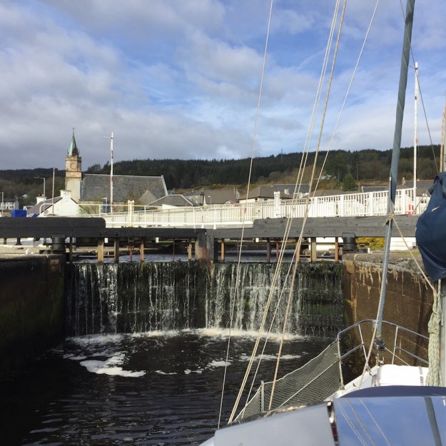
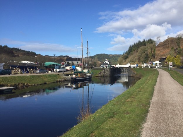
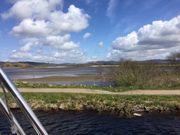
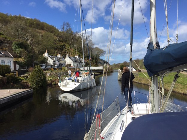
The engineering of the locks was fascinating. There were 15 in all and 7 bridges – the majority were swing bridges but one was a cantilever bridge. They were all kept in fantastic condition by the lock staff filling their time between boats by re-painting the locks and surrounding fencing in the characteristic black and white colours.

Leaving the sea lock through the swing bridge at ArdrishaigIMG_0758

Travelling uphill through the locks was most difficult to manage. The pilot guide recommended having at least four crew and a minimum of six fenders – preferably eight. As there were just two of us, we used The Yot Spot (http://www.theyotspot.com – 01546 602777) who provided crew for managing the shore side – operating the lock gates and sluices. Passing through the eight ascending locks there is a lot of turbulence when the sluices are opened to let water into the lock. You need crew at each end of the boat preventing it from skewing and bashing into neighbouring boats.

View from our mooring at Cairnbaan where we stayed the nightIMG_0791


It is always interesting to talk to other sailors you are paired with going through the locks. Garaidh, pronounced gæri, was returning to Banff in his yacht Bella (and with his dog Darcy) through the Caledonian Canal and got us excited about doing the same journey in September when we return to the boat after a break.

Going downhill towards Loch Crinan was much easier than going up, as water was let out of the lock and there was no turbulence inside. Keeping your lines loose and letting out the wharfs as the level rapidly lowered was essential. The lock operators gleefully told warning stories of boats getting hung up by a carelessly knotted mooring wharf and of irresponsible sailors leaving sluice gates open and the whole canal draining dry – not a popular outcome.

View across country to the sea from the highest point on the canalIMG_0834

Impressions – mine were that it was very strange motoring a sailing boat through the countryside when you are so used to seeing vast expanses of sea. Occasionally I was looking down on cars on a road across a field imagining them looking up in the opposite direction and wondering how a yacht was managing to sail across a field!

Rosamund loved the peace, the wildlife, and the picturesque nature of the trip. Even when with Garaidh we were held up for half an hour at a swing bridge as the lock keeper was at lunch – she thought – “that’s OK, “ and we rafted up against Bella and had a relaxed cup of tea and some lovely oatcakes rustled up by Garaidh at a moments notice.

Bella fae Banff leaving Lock 11 once the swing bridge was opened when the lock keeper returned after his lunch. IMG_0833

Earlier I’d met the owner of another Hunter Legend called Ulva from Ardrossen. He was on the first leg of a round Britain trip hoping to get back to Ardrossen by July. He was starting a blog (https://aroundbritainonulva.wordpress.com) which we now read with interest as they are forging ahead to some of the places we may visit.

Ulva going through Lock 2 near the beginning of their round Britain adventureIMG_0751

Waking up in the Crinan basin was wonderful. The water was like a mirror with perfect reflections. As we left through the sea lock, Jenny, the lockkeeper, had to break away from her painting of the locks to operate the locks hydraulically. The first hydraulic lock I’d seen. We were now heading for the western isles, but first a visit to Ardfern.

Crinan Basin at dawn from Milo – mirror images.IMG_0882


Port Bannatyne to the Crinan Canal

We left Bristol on Friday April 29th to travel north to Edinburgh to stay the night with Andrew, Rebecca and the grandchildren and pick up our sailing kit, left there the year before. We could not believe we were about to embark on a sailing odyssey – it was more like an arctic adventure as we passed through snow-laden hills and roads as we approached within 10 miles of Edinburgh.

Snow laden hills approaching EdinburghIMG_0697

But on the last day of April we left Edinburgh at lunchtime after Rosamund had indulged in a record provisioning shop. We could not believe we could get all those provisions on board particularly as we were planning to have Andrew, Hugh, Percy and Skye join us for the next two days.

Andrew had a crazy plan to leave his car at some junction on a bus route from Portavadie and catch the Colintraive Ferry across to Bute and have me (Ian) meet them all off the Ferry. In the end – the timing was such that it was quicker for me to cross the ferry myself and pick him up at the junction. The plan worked perfectly and by 8pm in the evening we were all enjoying a whole chicken roast cooked by Ros on the boat – the heat from the cooking being a welcome relief from the penetrating cold and a sea temperature of only 9C.

Catching the sunset on the FerryIMG_0699  
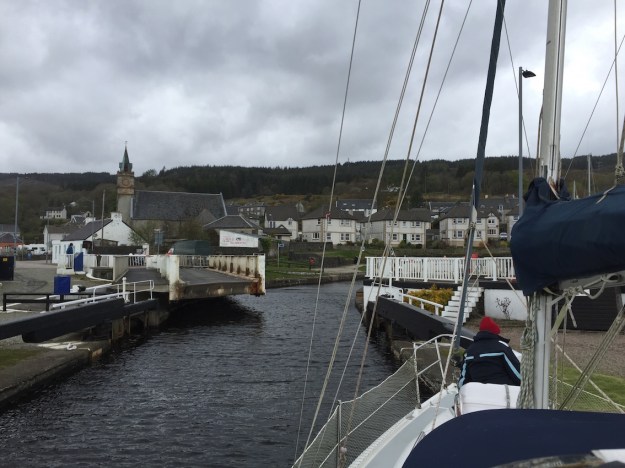
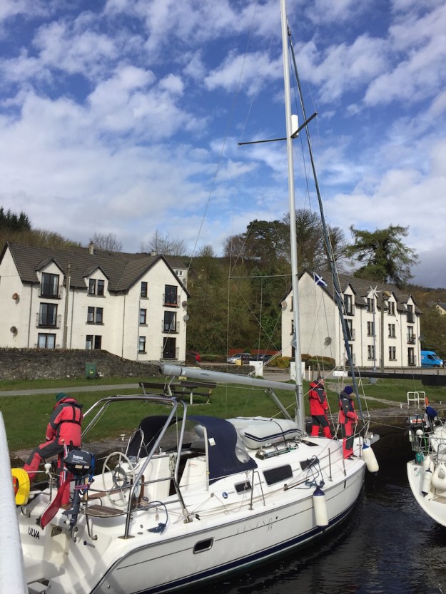
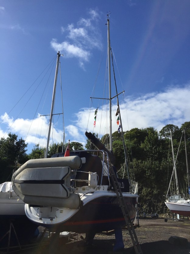
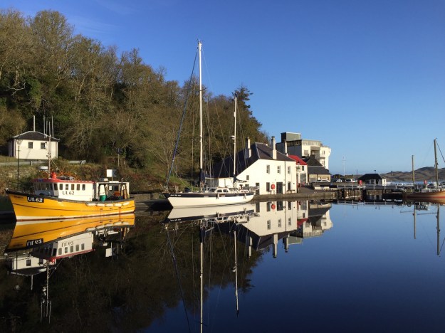
We’d had a lot of work done on the boat when she was out of the water. The sail drive had to be rebuilt as seawater was in the oil, we had our wind vane renewed and linked to the Raymarine Chart. But there were a few teething problems which John Stirling, the local Marina manager, helped us sort out on Sunday morning before we left.

Rosamund and I were a bit reluctant to leave as wind conditions were Force 4 gusting 5, but Andrew persuaded us that we had protection from the Kyles and should be OK. This proved to be the case and we had a decent sail up the East Kyle but had to motor up most of the West Kyle as we were head into wind.

Keeping lookout up East KyleIMG_0702

We quickly passed by the Kames hotel where we’d moored last year and headed for Portavadie after we’d rounded the headland. It was getting choppier now with the wind freshening and  Portavadie was a welcome refuge.  It was a rough night with thunder and lightning and hail storms, but  by morning the sun was shining even though the wind was too strong to go sailing.

We breakfasted with the grandchildren while Andrew  travelled by bus to retrieve his car. He was back in no time and after a bacon buttie for a late breakfast we all headed to the Spa. It was fun to go outside on a freezing cold day and sink into a hot-tub with views across the white crested water of Loch Fyne – not a sail boat in sight.

The Portavadie SpaIMG_0717 IMG_0718

The next day we decided, despite the bad weather, to head across Loch Fyne to Tarbert.   After a short crossing we found the old harbour to be a refreshing change from the rather characterless buildings of Portavadie.

Tarbert HarbourIMG_0732

We walked into town later and had an excellent meal at Starfish with Ros being very extravagant and having their seafood special with lobster, crab, langoustines, mussels and loads of shellfish.

Ros’s Lobster extravaganzaIMG_0734

As the weather was bad for the next 2 days we decided not to explore further up Loch Fyne, but to sail to the Crinan Canal early the next morning. Leaving at 7:00am and with a high swell on the sea, we soon arrived at  Ardrishaig, the entrance port for the Crinan Canal.

We circled at least four or five time waiting for the sea lock to open – the wind was too strong to berth on the waiting pontoon.IMG_0740


The Kyles of Bute – 2015

We’d heard a lot about how beautiful the Kyles of Bute were, but four days weatherbound in Port Bannatyne was enough to dampen our enthusiasm. We did go out on one of the grey wet days to venture up Loch Striven by sail and back against the wind by motor – but the beauty of the Loch escaped us behind the mist, the driving rain and the clouds.

What a contrast the next day – to sail in sunshine goose-winged with a following wind up the East Kyle. What is a Kyle anyway? After much research it turned out to be the Scottish word for a Strait – like the Straits of Gibraltar. A narrow passage of sea between two land masses. The Isle of Bute fits to the mainland like one of those tessellating shape games (Tetris) where the diamond shape has not yet been fitted into place. The Kyles of Bute comprise two narrow Straits or Kyles – one running NW to SE (the East Kyle) and the other running NE to SW for most of the time. Sailing through the Kyles of Bute is a challenge for any sailor as the wind tends to funnel along the Kyles or suddenly changes as the topology of the surrounding hills changes. Even the locals warned us that the winds were unpredictable. They also warned us to steer clear of the Waverley as the captain had a reputation for ignoring sailing vessels and steaming straight on at 14 knots regardless.

Sailing through Caladh HarbourIMG_7922

Our sail to the meeting of the two Kyles was uneventful and luckily for us, we did not meet the Waverley as we navigated our way through the narrows of the Burnt Islands to the lovely anchorage of Caladh harbour and round the island of Eilean Dubh past Caladh Quay where it looked like a youth club were preparing their boats for a sailing race. Leaving Caladh we started tacking our way into the head wind making very slow progress as the winds were light. But now we were not in a hurry to get anywhere – we had all the time in the world and the scenery was beautiful with numerous yachts on the move – some sailing, but the majority motoring. We passed Tighnabruaich looking for potential mooring places, but Rosamund had read about the Kames Hotel that had its own mooring buoys for yachts. And they were very welcoming and served excellent food. We had a very peaceful night on their swing mooring. The sunset was exquisite and the views from the boat in the morning so peaceful and smooth – such a contrast to the four grey rainy days earlier.

Sunset in KamesIMG_7948


A trip to Post Office in Kames the next day led to the discovery of many effigies in the village. Was it an early Guy Fawkes day? No, there was a scarecrow competition in Argyll and Kames and their residents had made a number of innovative contributions.

Kames Scarecrows

IMG_7972IMG_7968IMG_7970

We tried tacking south against the Southerly wind the next day. We even “raced” against another Hunter Legend 306 – but a lull in the wind persuaded us to motor to the headland where we could get a better course for sailing with the wind on our port beam all the way to Portavadie. We called it Portaverdie as it sounded slightly Italian. It was a new Marina with 250 berths and masterchef restaurant and a massage/beauty/therapy centre with an infinity pool about to open at the end of the year.

Our first course in the Portavadie Marina RestaurantIMG_7987

Berthed next to us was a huge motor cruiser Reala II – the owner said he hoped I would not mind, but he’d taken a picture of our boat to send to his daughter in Australia as her new partner was called Milo!! What surprised me when discussing his boat was that it could go 20 mph but used 225 litres of fuel per hour. Admittedly Milo could only manage 5 knots or 5.5 mph, but it only used 1.4 litres of fuel an hour – quite a contrast.!!

Our last day returning to Port Bannatyne was a 21nm sail and this time we did sail all the way. The winds were stronger so we were able to make 4-6 knots most of the time. The West Kyle was a breeze and the Southerly wind channeled behind us to push us quickly up the West Kyle to the Burnt Isles. We had to tack through the narrows between Bute and the Burnt Isles and then came across both the Colintraive Ferry and the Waverley while beating into a strong wind with little leeway. We managed to tack across the ferry on the starboard tack but had to go about just before the Waverley passed – so at one point it looked as if we were on a collision course, but she was travelling very fast so passed across our bow with about a hundred metres to spare.


The Waverley crossing our bow very close and at speed

IMG_8001

Then we tacked up the whole East Kyle and, as time progressed and we were half way between low and high tides, we must have been tacking against a strong tide as I noticed our track was getting more and more concertinaed.


Milo Picture from Reala II

OLYMPUS DIGITAL CAMERA


We were thankful to arrive back in Port Bannatyne and berth at our familiar berth and assumed it was coincidence that the rain was starting yet again.

The next day Ian took the ferry to the mainland and then the bus to collect the car from Ardrossan, returning to Port Bannatyne Marina to load up for our return journey to Edinburgh for the Festival.

Milo was lifted out the following week and while on the crane had some mast-top repairs done to restore the missing wind vane and fit a wind vane.

Milo in winter storage until April 29th, 2016.

IMG_8077